Capturing a new capability for PNG
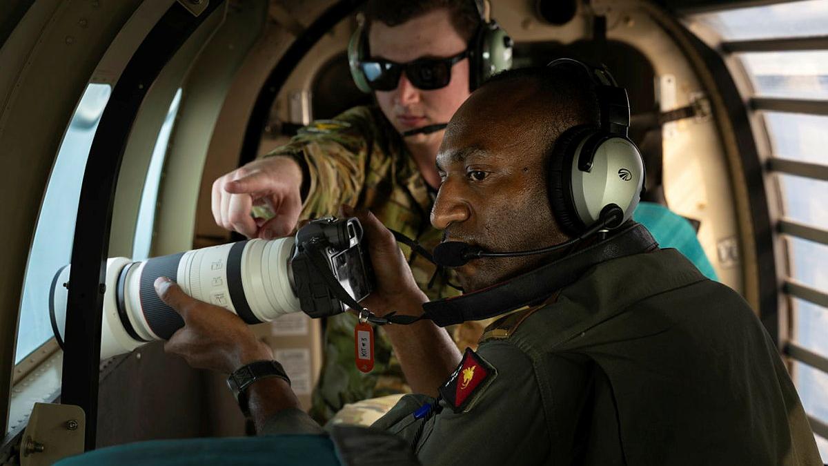
From the back of a Papua New Guinea Defence Force (PNGDF) Air Transport Wing (ATW) PAC-750, the landscape is a constantly changing picture – ocean one moment, dense jungle the next.
During Exercise Kapa Pisin 26, RAAF imagery specialists LAC Jakob Reid and LAC Jamie Kohlmann introduced PNGDF ATW personnel to aerial photography techniques, teaching them how to operate a camera from a moving aircraft to capture intelligence imagery.
The training put theory into practice, with pilots conducting flying runs around vessels in the harbour to photograph them from different angles.
For the PNGDF pilots, the skills have practical applications beyond the training flight.
Second Lieutenant Rothman Spaiye, of the PNGDF, said learning to operate the camera was a valuable first step towards incorporating aerial imagery into the PNGDF’s ISR activities.
“It’s very important for intelligence and reporting,” Second Lieutenant Spaiye said.
“It’s been very helpful to learn the functions of the camera.”
Unlike photography on the ground, capturing imagery from an aircraft requires precise timing and preparation, with only a brief window to identify and photograph a target.
“The main thing to consider is the movement, but once you have your settings right it’s set and forget,” LAC Reid said.
“There’s also a very short window when an aircraft passes something, so it’s about being ready to capture that moment.
“Photographing vessels against the contrasting colours of the ocean presented different challenges to capturing imagery over jungle terrain, where the aircraft and target could be harder to distinguish against the background.”

The pilots quickly adapted to the challenge, producing usable imagery by their second run.
For LAC Reid, the activity was also an opportunity to step into the instructor’s role and share his specialist knowledge with regional partners.
“It was my first time instructing a foreign force and I really enjoyed it,” he said.
“Everyone was really receptive to the training and picked it up quickly.
“It was special seeing the students take the photo and see on the back of the camera that they nailed the shot. The way their faces light up, it reminds me of when I first got to experience that.”
As an island nation with an extensive maritime domain, PNG relies on the ability to monitor activity across its waters.
“Aerial imagery can help inform situational awareness and support the reporting of activity at sea,” Second Lieutenant Spaiye said.
The training contributes to the PNGDF’s ability to develop and employ its own surveillance capabilities, while strengthening the practical skills of personnel operating its aircraft.
For LAC Reid, the value lies in sharing knowledge that can be put to work long after the training flight ends.
By equipping PNGDF personnel with the skills to capture aerial imagery, the activity supports a more capable partner force and strengthens Australia’s ongoing defence cooperation with PNG.

Related stories


